
Through its Cycling Master Plan and simplified Mobility Plan (available in the Projects section), the Communauté de communes de Serre-Ponçon aims to encourage and promote cycling, both for everyday travel and for leisure.
In concrete terms, this involves building 35 kilometers of cycle routes between communes along the Serre-Ponçon river.
Find out more on this page about completed and planned cycle paths.
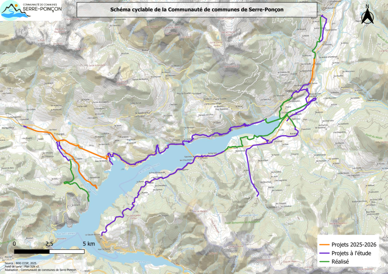
Existing facilities
The map below shows existing facilities built by the Hautes-Alpes department, communes, SMADESEP (Syndicat Mixte d'Aménagement et de Développement de Serre-Ponçon) and the Communauté de communes de Serre-Ponçon.
A brief glossary :
- Voie verte (greenway): a dedicated right-of-way reserved for pedestrians, cyclists, rollerbladers, people with reduced mobility and horse riders. Motorized traffic is prohibited. = "cycle track
- Cycle lane: lane reserved exclusively for bicycles on the side of a multi-lane carriageway
- Unmarked central-lane carriageway ("chaucidou"): narrow carriageway with no central markings. Motorized vehicles travel in a two-way central lane, while cyclists use the two side lanes.The central lane does not allow two vehicles to pass each other. Vehicles are allowed to use the side lanes when crossing, without endangering pedestrians and cyclists.
Planned developments
The Communauté de communes de Serre-Ponçon is a winner of the French government's "Territoires Cyclables" call for projects, and has been awarded 2.4 million euros in funding. The project has also received funding from Europe, the Region and the Département.
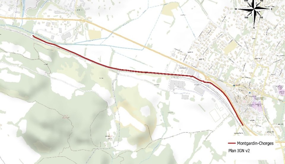
Chorges
- Project 2026-2027
- Greenway to the municipal boundary with Montgardin
- Estimated cost: €605,000 excluding tax
- This section is part of the ongoing Gap - Chorges itinerary project
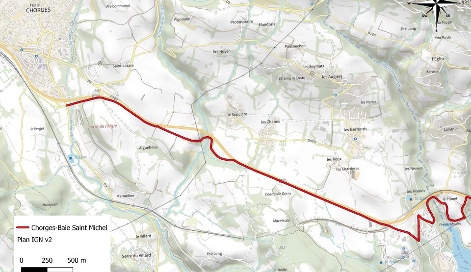
Chorges - Baie Saint Michel
- Project 2026-2027
- Green route
- Estimated development cost: €1,900,000 excluding VAT
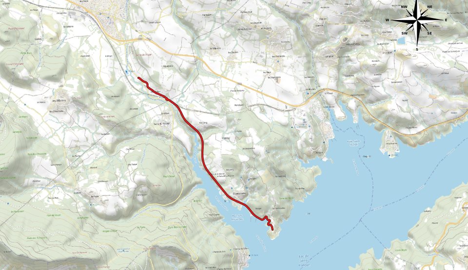
Chorges - Chanteloube Bay
- Project 2026-2027
- Roadway with central unmarked lane
- Estimated cost: €510,000 before tax
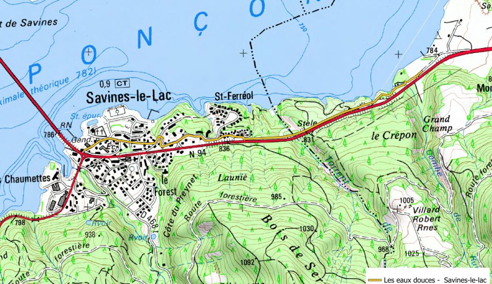
Crots Les Eaux Douces - Savines-Le-Lac
- Under study
- Green route
- Estimated development cost: €4,085,494 excluding VAT
Chorges Baie Saint-Michel - Savines-le-Lac Station
- Feasibility study completed
- Land study to come
Savines-le-Lac Gare - Embrun Chadenas
- Via the right bank of the Durance
- Under study